The GeoCitizen Framework
GeoCitizen is a digital hub for Community Management, Citizen Participation and Citizen Science. It supports citizen participation processes, community initiatives, citizen science projects and voluntary engagement on different geographic and administrative levels. The core aim of GeoCitizen is to establish a transparent and structured communication process for stakeholders involved in participatory processes and topics such as citizen-oriented municipal development, climate change adaptation in smallholder farming, emergency response, and the revitalization of abandoned urban spaces, among others.
GeoCitizen supports the collaborative development and implementation of projects with communities, public authorities, academia, local experts, private enterprises, and other stakeholders, facilitating the construction and exchange of local knowledge across various topics and application domains.
How can GeoCitizen help me?
GeoCitizen is a versatile digital platform designed to facilitate participatory processes in various sectors, including urban planning, environmental management, and community development.
It serves as a collaborative tool for municipalities, research institutions, private enterprises, NGOs, and grassroots organizations worldwide, enabling them to engage stakeholders in decision-making.
The platform is multilingual and offers tailored functionalities to users based on their specific needs in participatory projects.
For agricultural development, GeoFarmer builds upon the GeoCitizen framework.
By leveraging the participatory principles of GeoCitizen, GeoFarmer enhances digital inclusion in agriculture, ensuring smallholder farmers and farming communities can contribute to and benefit from agricultural innovations.
GeoFarmer is extending the capabilities of the GeoCitizen Framework with modular tools specifically designed for farmers, researchers, and agricultural extension services.
GeoCitizens
Enabling Participation
GeoCitizen Modules and Functionalities
Based on a common modular framework, the GeoCitizen application can be smoothly framed to specific projects and geographic extents:
- Multi-Purpose: Multi-language, multi-purpose, multi-domain
- Multi-Device: Platform flexibility through Progressive Web App
- User Management: User- and role management and guest user access possible
- Geo-Integration: Full map integration to display geo-features and base maps
- Offline activities can be syncronized when online mode is active Offline-Aktivitäten können bei erneuter Online-Verbindung synchronisiert werden
The modules of the GeoCitizen hub are specifically tailored to the use in different application domains:
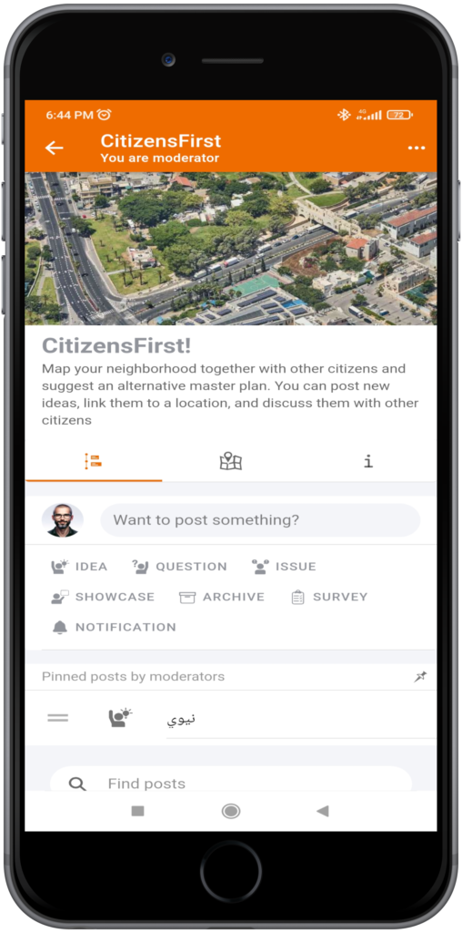
- CITIZEN ENGAGEMENT: Engagement Module assists in the set-up and management of transparent and sustainable participatory community planning projects through map-based reports (issues, ideas, favorite places), discussions, polling and transparent solution-building processes.
- PARTICIPATORY CSR: The P-CSR Module facilitates the involvement of local enterprises, and their Corporate Social Responsibility (CSR)-programs in participatory community planning through supporting the design, management, implementation, and sponsorship of participatory projects or initiatives.
- GEOFARMER KNOWLEDGE NETWORKS: GeoFarmer is designed to support experience exchanges between farmers – be they positive or negative – so that they can learn from each other by asking questions and by sharing suggestions on how their crop, animal, and climate-resilient farm management.
- SMALLHOLDER SELF-EUDR: Empowering Farmers for Deforestation-Free Compliance. Farmers simply use their smartphone to collect EUDR-relevant data, receive real-time deforestation compliance status, and share compliance data with business partners.
The core functionalities of the GeoCitizen application include a set of features that support a participatory process in various ways:
- PEER-TO-PEER KNOWLEDGE SHARING: The Peer-to-Peer Knowledge functionalities allow users to easily provide specific input and best practice cases to their communities, ask for feedback in certain fields of interest, discuss common challenges and solutions, and build a common knowledge base on a specific topic.
- GEO-ENABLED SURVEYS and OPINION POLLS: Geo-enabled surveys and opinion polls extend standard survey functionalities with features for geographical analysis and visualization. This allows users to create geo-referenced questionnaires and the spatially aggregated presentation of your survey results on easy-to-share digital maps.
- FACILITATOR-LED SURVEYS: Facilitator-led surveys support your project team in interviewing persons that are not able to complete a digital survey on their own due to technical or personal restrictions (elderly or handicapped persons, etc).
- SURVEY TREES: Survey Trees help to structure complex surveys through applying a set of logical and mathematic conditions (if-then, etc.). This assists you in personalizing your questionnaires to the needs of the end users, keeping track of sophisticated issues.
- USER-GENERATED GEOGRAPHIC INPUT-LAYERS: Geospatial features and background layers can be easily integrated into the GeoCitizen application as key components for crowdsourcing local knowledge and assessing various decision-making and planning scenarios.
- SKETCH MAPS: On Sketch Maps, users can share their input on a specific issue or communicate their ideas in a creative way by drawing freehand on a digital map. Results can be easily integrated in further discussions or processes.
- PUSH/SMS NOTIFICATIONS: Push-Notifications assist process managers in keeping their communities up-to-date on the latest developments of their projects and iniciatives, as platform (push) notifications or Short-Message-Service (SMS).
- ALERT NOTIFICATIONS: Notifications help community leaders and organizations to verify third-party-information on emergency events and therefore better manage emergency response actions in their communities.
- DATA CALCULATOR: After users’ input of requested data, compound variables are calculated following metrics, which are defined by a moderator and provide insights on defined criteria.
Scientific Publications
ATZMANSTORFER, K. and T. BLASCHKE (2013). The Geospatial Web: A Tool to Support the Empowerment of Citizens through E-participation? In Citizen E-Participation in Urban Governance: Crowdsourcing and Collaborative Creativity, pp. 144-170. IGI Global. https://doi.org/10.4018/978-1-4666-4169-3.ch009
ATZMANSTORFER, K., RESL R., EITZINGER, A. and X. IZURIETA (2014). The Geo-Citizen approach: community-based spatial planning – an Ecuadorian case study. Cartography and Geographic Information Science. 41(3), pp.248-259. https://doi.org/10.1080/15230406.2014.890546
ATZMANSTORFER, K., EITZINGER A., MARIN B.E, PARRA ARTEAGA, A., GONZALEZ QUINTEIRO, B. and R. RESL (2016). HCI-Evaluation of the GeoCitizen-reporting App for Citizen Participation in Spatial Planning and Community Management among Members of Marginalized Communities in Cali, Colombia. Journal of Geographic Information Science. 4(1), pp. 117-132. https://doi.org/10.1553/giscience2016_01_s117
EITZINGER, A., COCK, J., ATZMANSTORFER, K., BINDER, C.R., LAEDERACH, P., BONILLA-FINDJI, O., BARTLING, M., MWONGERA, C., ZURITA, L., & JARVIS, A (2019). GeoFarmer : A Monitoring and Feedback System for Agricultural Development Projects. Computers and Electronics in Agriculture 158: 109–21. https://doi.org/10.1016/j.compag.2019.01.049
BARTLING, M., RESCH, B., TROESTERER, S. & Eitzinger, A (2021). Evaluating PPGIS Usability in a Multi-National Field Study Combining Qualitative Surveys and Eye-Tracking, The Cartographic Journal, https://doi.org/10.1080/00087041.2020.1842143
EITZINGER, A (2021). Data Collection Smart and Simple: Evaluation and Metanalysis of Call Data From Studies Applying the 5Q Approach. Front. Sustain. Food Syst. 5:727058. https://doi.org/10.3389/fsufs.2021.727058
ATZMANSTORFER, K., BARTLING M., ZURITA ARTHOS, L., GRUBINGER-PREINER, J., FEIL, C. and A. EITZINGER (2023). Making Corporate Social Responsibility (CSR) participatory and locally visible – a prototype solution. Paper submitted to the International Journal of Geoinformation (IJGI) – MDPI on October 26, 2023. https://doi.org/10.20944/preprints202311.1105.v1
ATZMANSTORFER, K., BARTLING, M., HALTOFOVÁ, B., ZURITA ARTHOS, L., GRUBINGER-PREINER, J., and A. EITZINGER (2024). Critical Success Factors of participatory community planning with geospatial Digital Participatory Platforms. Paper submitted to the International Journal of Geoinformation (IJGI) – MDPI on June 17, 2024.
The following presentations and workshops were conducted at scientific conferences and community symposia to support the development process of GeoCitizen:
- Eitzinger, A., Marenya, P., Rickards, C., Chiduwa, M.S., Feil, C., Fisher, M.G. Empowering African Farmers Through Digital Knowledge Exchange Networks. Poster, Tropentag, BOKU-Vienna, Austria, September 2024.
- Eitzinger, A., Feil, C., Ekue, M., Oduor, F., Kettle, C. GeoTree: A participatory digital tool for forest landscape restoration in the tropics. Poster, Tropentag, Humboldt-Universität zu Berlin, Germany, September 2023.
- Atzmanstorfer, K. Das Bürgercockpit. Gemeinde 4.0 – Neue Technologien im Dienste der Alpenbevölkerung. Allianz in den Alpen – Das Gemeindenetzwerk. Online-Symposium, October 2021.
- Atzmanstorfer, K. und M. Bartling. Corporate Social Responsibility und Bürgerbeteiligung – Das Bürgercockpit. Workshop, AGIT 2021. Salzburg, Austria.
- Eitzinger, A., K. Atzmanstorfer & M. Bartling. Take Climate Action in Your Neighborhood. ISDE 12 Youth Forum 2021. Salzburg, Austria.
- Atzmanstorfer, K. El GeoCiudadano viaja entre Cali, Quito y Salzburgo. ForoMundoUNIGIS Latin America 2020. Online-Symposium.
- Atzmanstorfer, K. Pilotprojekt Bürgercockpit. Methodenlabor Bürgerbefragung 2020 – Regionalmanagement Oberösterreich. Kremsmünster, Austria.
- Atzmanstorfer, K. Das Bürgercockpit – Agenda 21. Austauschtreffen der Digitalen Dörfer Bayern 2019, Kirchanschöring, Germany.
- Atzmanstorfer, K. und T. Blaschke. The GeoCitizen geoweb-participation framework – applications and critical success factors. ISPM Conference, June 2019. Aalto University, Espoo, Finland.
- Atzmanstorfer, K. Das Bürgercockpit – Denkräume Beteiligung Agenda 21. Netzwerktreffen Zukunftsakademie Oberösterreich 2018, Kronstorf, Austria.
- Atzmanstorfer, K. Das Bürgercockpit – Workshop Digitale Beteiligung. 8. Österreichischer Agenda 21-Gipfel Innovationskraft Beteiligung − Chancen für Stadt und Land, September 2017. Salzburg, Austria.
- Blaschke, T. & K. Atzmanstorfer. The GeoCitizen Participation Framework. Modern Methods and Tools for Public Participation in Urban Planning 2017 Symposium, Poznan, Poland.
- Atzmanstorfer, K., Eitzinger, A. & R. Resl. MOOC for Local GeoExperts – How to empower citizen engagement with GIS. ESRI User Conference 2017, San Diego, USA.
- Resl, R., Atzmanstorfer, K., & A. Eitzinger. Geo-designing citizen engagement – from rainforests to urban communities. The GeoCitizen approach. ESRI User Conference 2017, San Diego, USA.
- Resl, R., Atzmanstorfer, K., & A. Eitzinger. Application of geospatial web-platforms in participatory community planning – the ‘Barrio Bonito (Pretty Neighborhood)’ – GeoCitizen approach, Quito Sur, Ecuador. ESRI User Conference 2016, San Diego, USA.
- Atzmanstorfer, K., Eitzinger A., Marin B.E, Parra Arteaga, A., Bryan Gonzalez Quintero, B. & R. Resl. HCI-Evaluation of the GeoCitizen-reporting App for citizen participation in spatial planning and community management among members of marginalized communities in Cali, Colombia. GI_Forum 2016, Salzburg, Austria.
- Bartling M., Sotelo S., Eitzinger A., Atzmanstorfer K. Press the Button: Online/Offline Mobile Applications in an Agricultural Context. GI_Forum 2016, Salzburg, Austria.
- Atzmanstorfer, K. Aplicación de plataformas geoespaciales en la planificación comunitaria – Plataforma GeoCiudadano e Iniciativa Barrio Bonito Quito Sur. ForoMundoUNIGIS Buenos Aires 2015, Argentina.
- Atzmanstorfer, K., Eitzinger, A. & R. Resl. Community Engagement Application – GeoBarrio, Quito – Ecuador. ESRI User Conference Europe 2015, Salzburg, Austria.
- GI for Managing Vulnerable Environments of the Galapagos Islands, Joint-Workshop PLUS (Paris Lodron University Salzburg) – USFQ (University San Francisco de Quito) 2014. Galapagos, Ecuador.
- Eitzinger, A., Atzmanstorfer, K. & R. Resl. The GeoCitizen approach – Implementation of a collaborative participation framework for citizen collaboration. International Conference on Environmental Information and Communication 2013, Bogotá, Colombia.
- Atzmanstorfer, K., Community-based spatial planning with social geo-web platforms. AGILE PhD School 2013. Schloss Herrenchiemsee, Germany.
- Atzmanstorfer, K. y A. Eitzinger. Iniciativa GeoCiudadano. ForoMundoUNIGIS 2013, Cali, Colombia.
- Resl, R., Eitzinger, A. & K. Atzmanstorfer. Platform for Collaborative Problem Solving within the Citizen´s Spatial Context – the Geo-Citizen framework. ESRI User Conference 2012, San Diego, USA.